Dear colleagues at ECMWF,
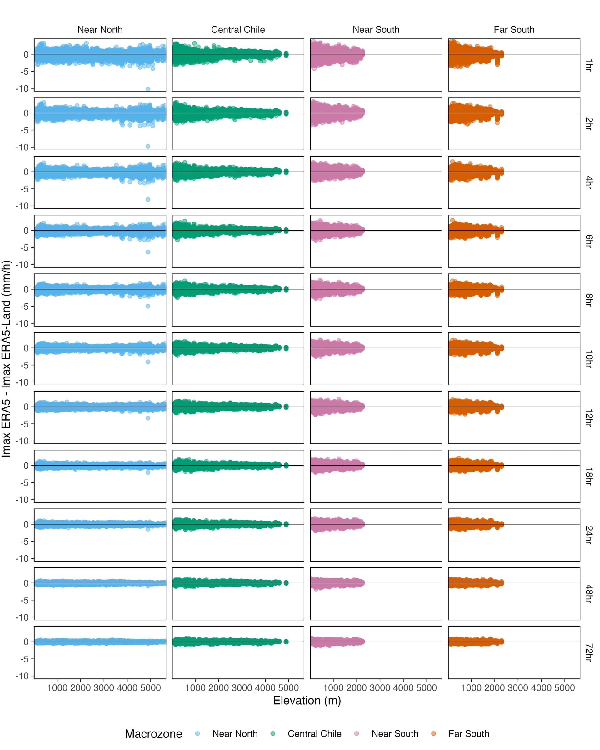
We are conducting research on maximum precipitation intensities in Chile using the ERA5 and ERA5-Land datasets. In the course of our work, we have observed differences in maximum precipitation intensities between both products, with these differences tending to be greater in low-elevation areas within our study region.
We understand that ERA5-Land precipitation is derived from ERA5, which is interpolated to a higher resolution of 9 km. Based on the provided documentation, this interpolation process is performed using a linear interpolation method based on a triangular mesh. We also understand that, unlike thermodynamic variables such as temperature, humidity, and pressure, which are adjusted for elevation differences using an environmental gradient, no direct bias correction is applied to ERA5 precipitation in ERA5-Land, nor is a specific elevation correction applied to the precipitation itself. Is that correct?
Our specific question is: What specific differences are expected in the characteristics of precipitation, including maximum intensities and their spatial distribution, between ERA5 (at approximately 31 km) and ERA5-Land (at approximately 9 km)?
Furthermore, is there any known characteristic of the precipitation downscaling approach (linear interpolation without explicit bias or elevation corrections) that could help explain the larger differences we observe in maximum precipitation intensities in low-elevation areas compared to higher-elevation areas, or compared to the ERA5 product itself? Below, we show a figure that illustrates the differences in annual maximum precipitation intensities between ERA5 and ERA5-Land in Chile.
Lastly, we would also like to ask whether ERA5 uses the GPCC and GPCP products.
We appreciate your time and guidance in advance regarding what to theoretically expect from the relationship between ERA5-Land precipitation and ERA5.
Best regards,