Hello,
I used the CDS API in python to download data for ERA5-Land Hourly from 2010 to 2013 for all the days and months for Bavaria in Germany. I used a shapefile of Bavaria to extract the coordinates of the bonding box. The output format was selected as netCDF and dataformat was unarchived.
Initially I downloaded the data for a few variables like t2m, d2m, swvl1, swvl2, sp, ssr, and str.
Then I realised I also needed the data for evaporation and hence I used the exact same script and the same bounding box coordinates to download the evaporation data.
The coordinates for the two datasets should be the exact same as it was the same bounding box. That is why I thought of merging the two datasets later.
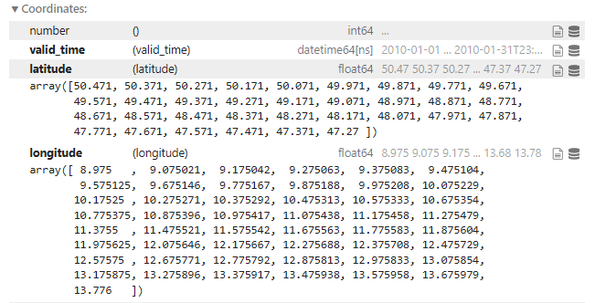
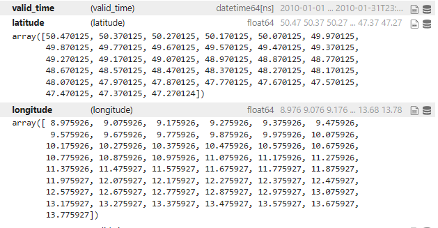
However, there is a very slight difference in the coordinates. The difference is till the 100th place but still the coordinates are not the same hence I cannot merge the data. I have to regrid using the nearest neighbor method. Please see the attached images to see the difference in the coordinates. Why this might be
happening? And how can I make sure that in the future if I download multiple datasets using the same extents, the coordinates stay the same?
These are the coordinates of the first dataset:
These are the coordinates of the second dataset:

