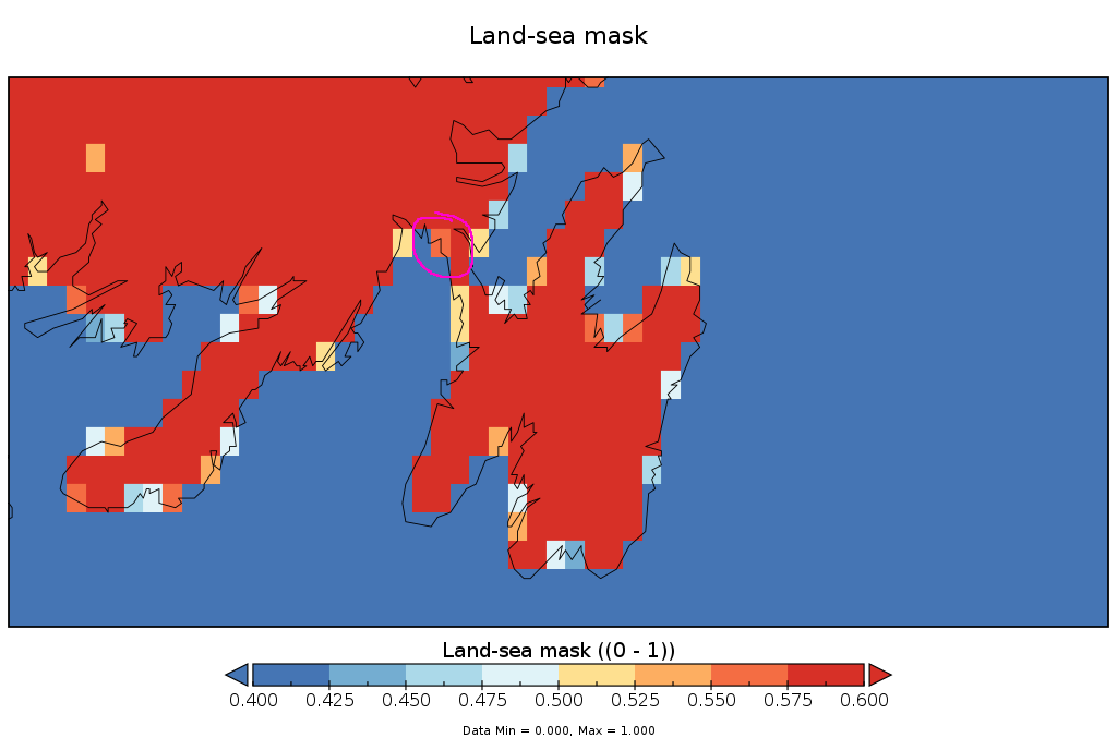
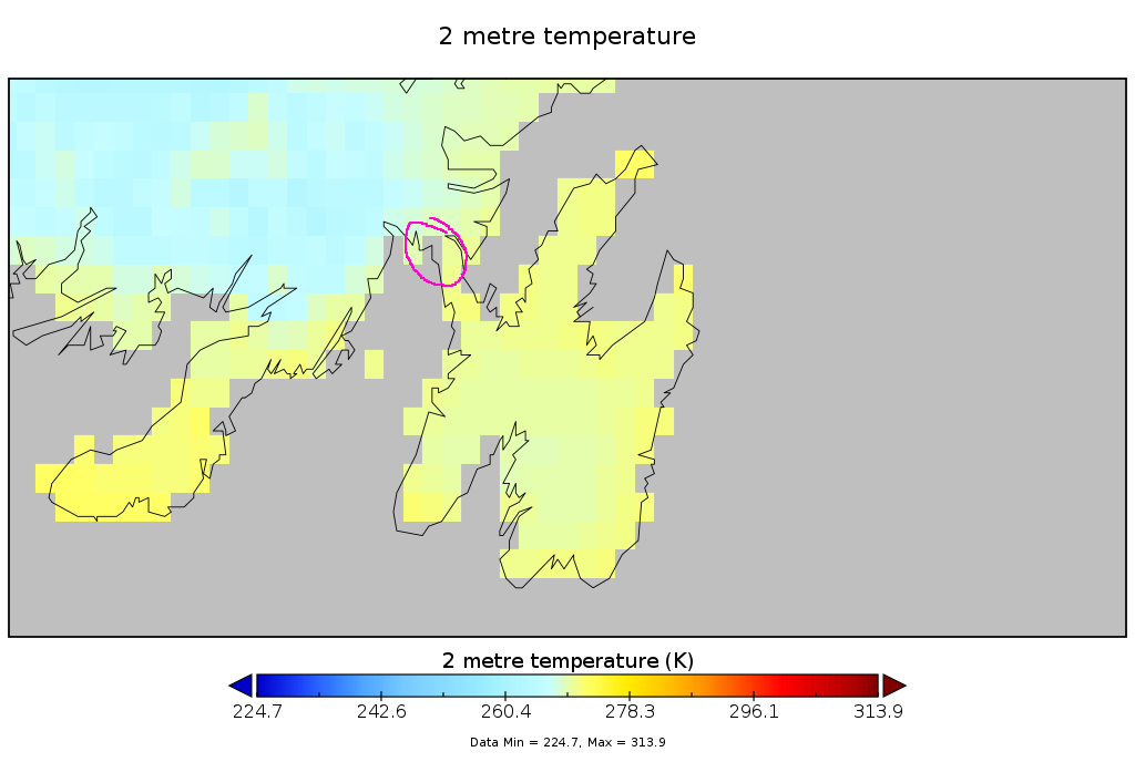
ERA5-Land is obviously available only over “land”. However, it seems the definition of “land” doesn’t necessarily correspond to the land-sea-mask provided. If you grab a variable, say 2m temperature, and examine the NaNs and compare to the land-sea-mask, you:
- get some cells with a defined temperature with land-sea-mask values < 0.5 (as low as 0)
- get some cells without a defined temperature with land-sea-mask values > 0.5 (as high as 0.8)
For example, see the attached land-sea-mask for the southeastern tip of Newfoundland and the equivalent picture for t2m. Any land-sea-mask > 0.5 is orange/red while < 0.5 is blue. I’ve circled one location that has a land-sea-mask of 0.565 yet has a NaN temperature. There are many other examples in these images.
Given the number of interesting places that are adjacent to coastlines, extracting data for a given (lat, lon) can be hit-and-miss on whether you’ll get NaNs or not.
Anybody else run into this?