Hello everyone,
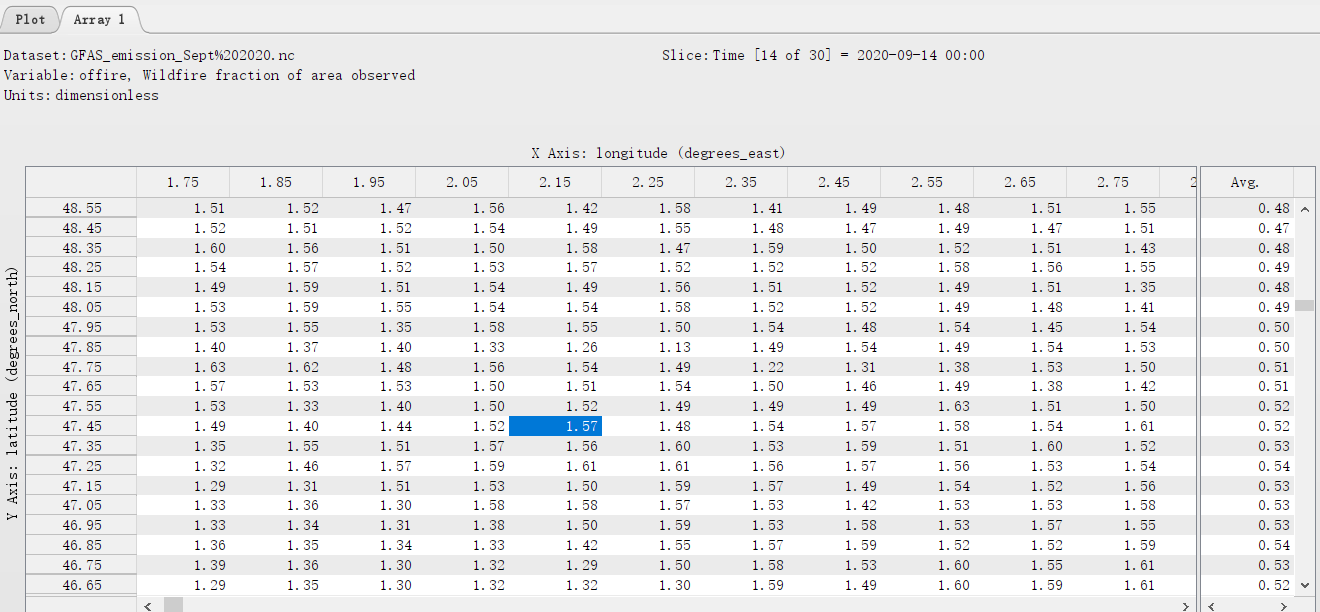
I'm using GFAS inventory to study the emission of a wildfire. However, I found the wildfire fraction of area observed, offire, is larger than 1. Sometimes for the non-wildfire areas, the values are still larger than 1.
For instance, a small fire (36 ha) occurred on 14 September 2020 at 47.3726°N, 2.12987° E. As shown below, the offire values are larger than 1 at this location. In fact, locations around this place also have offire values larger than 1.
So, I could not use this parameter to calculate the burned area (grid area*offire). Does anyone know how to use offire? And how to calculate the burned area with GFAS?
Thank you!