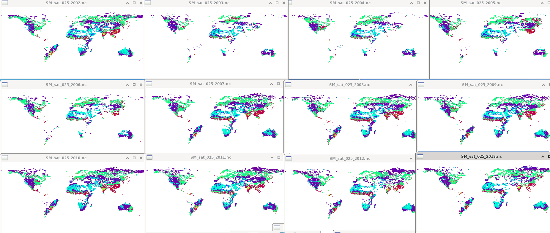
During a recent meeting with some members of ECMWF, I brought up the issue of missing large amounts of missing data in the gridded satellite soil moisture product. As discussed, I therefore submit a ticket showing this.
This is particularly the case in 2003. I attach a (very basic screenshot) png showing soil moisture for August 2002-2013 (left→right, top->bottom). This is for combined passive and active data.
The documentation mentions:
Based on the sensitivity to vegetation density, we decided for each pixel whether to use either
the scatterometer or the radiometer retrievals, or to use a weighted average of the available
observations from different sensors. This merging scheme may lead to data gaps in the
following situations:
o No observation is available (sensors fail). This is for example the case between 2001
and 2006 in Western Europe, parts of Siberia, parts of North and South America, due
to failure of the onboard storage capacity of ERS-2.
I therefore draw it to attention here, as it is a challenge to use this data. I hope this is helpful.