Hi,
I am trying to look at 3D ERA5 wind data from the model level zarr archive available on google cloud (gs://gcp-public-data-arco-era5/ar/model-level-1h-0p25deg.zarr-v1). I want to look at profiles and reference them in the vertical with respect to ground level. For that, I have downloaded the 3D and the surface geopotential fields, and used the following formula:
Geometric height = geopotential * Re / (g*Re - geopotential)
where Re is the earth radius (6371000m) and g the standard gravity (9.80665 m/s^2),
Then,
Geometric height wrt ground level = hybrid level geometric height - surface geometric height
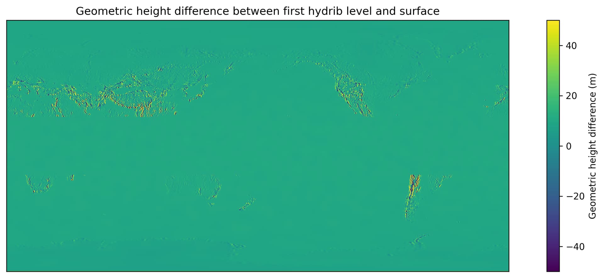
If I look at the maximum and minimum geometric height at the surface for a specific timestamp, I get values respectively slightly smaller than 5900 and around 140, which seems OK given the resolution of the model.
Now, when I look at the height of the vertical hybrid level the nearest to the surface, I would expect a value close to 10 metres. As shown on the figure below, this seems to be the case in the ocean and within the tropics, however, on land I find large variations ranging roughly between ±200 metres. Apart in the tropics, the magnitude of the geometric height with respect to ground level as calculated here seems to be related to the gradients in orography. I have a suspicion this could be related to the difference in grid/interpolation between surface and model level geopotential.
Could you please help me to shed some light on whether my initial approach is sound and on what might be the cause of the patterns I am observing. Could you also please give me some pointers on a way I could accurately reference the hybrid level data with respect to ground level.
Many thanks
Sebastien