Hi!
I downloaded ERA5-Land snow variables from the CDS (density, depth, cover) and I noticed a weird pattern near the lakes. From the documentation, I understand that the lake module does not have any snow accumulation. This results in 0 m snow depth on pixels that are 100% lake, good enough. Looking at the points with low lake cover, I understand that the lake part of the grid cell was not taking into account in the aggregation. As the doc says, the snow data is valid for the part of the gridbox covered by snow, which excludes the lake part. However, it looks like there’s a correlation between snow depth and lake cover for pixels with a large lake fraction.
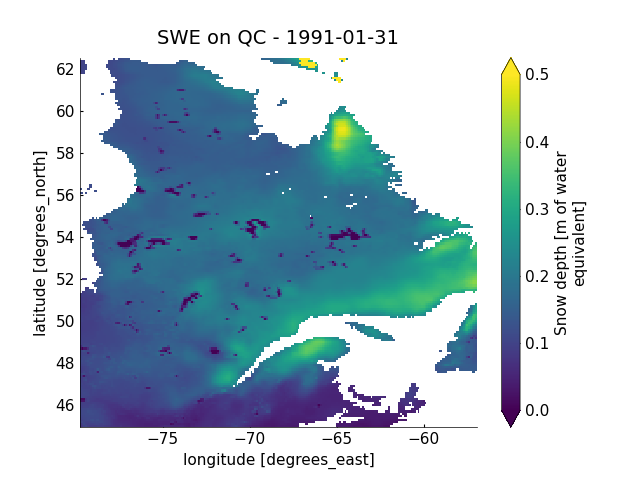
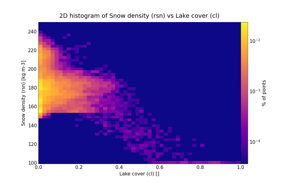
This is even more clear in the snow density field. I am not a snow expert, but it seems to me that proximity to a lake should not have an impact on the snow density. On lakes, where there is no snow, snow density seems to be set to 100 kg m-3. Here is a plot of the snow depth on 1991-01-31 for my study domain (Quebec, Canada) and a 2D histogram of the snow density vs lake cover for the same day and domain.
My theory is the following:
- On the native grid, constant values of 0 m (depth) and 100 kg m-3 (density) are use to fill cells that are 100% lake.
- The other cells have the values for the land part only.
- What we download from CDS is regridded from the native grid to a regular lat-lon grid. Thus, a destination pixel that overlaps a lake-only cell and a mixed (or land only) cell receives a value that is the average of both source pixels.
If I’m right, this would have the effect to artificially lower the snow values near large lakes, which I think is what I’m seeing in my data. Is my interpretation and explanation correct ?
Thanks!