Hello.
I am trying to download the soil moisture content data from the EFAS hydrological reanalysis version 5 product: (River discharge and related historical data from the European Flood Awareness System)
This product gives sub-daily soil moisture data for 3 soil layers at sub-daily time steps for multiple years.
The soil layers information is in the variable soil depth, which gives the depth of the bottom of each layer from the surface. This is where I noticed something strange. The official documentation (Model Output - Copernicus Emergency Management Service - CEMS - ECMWF Confluence Wiki) gives the units as meters.
But when I upload the netCDF file in Python using xarray and actually check it, the soil depth for layer 1 goes till 50 meters, and the soil depth for layer 2 goes till 1400 m (1.4 km !!!). This does not seem realistic, as I have never seen a hydrological model or a land surface model working with these high depths of soil, unless the focus is on the deep layers.
Is it possible that the units of soil depth is millimeters instead of meters? Then a depth of 50mm (5cm) and 1400 mm (140 cm) would make much more sense.
Even ERA5-Land has soil water moisture data for similar depths (7 cm, 28 cm etc.)
Can you please let me know if I am missing something?
Here is a plot for soil depths for layer 2 for a part of Croatia, and you see the values go till 1400:
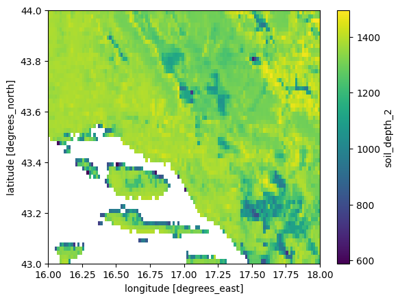
So the main question is: is it 1400 meters? or cm? or mm?
With kind regards,
Karan