It is not clear to me how the wind field at a specific location is different between the two models.
The ERA5-Land documentation (Muñoz-Sabater et al, 2021) explains that it is "driven by atmospheric forcing derived from ERA5 near-surface meteorology state and flux fields," with the atmospheric forcing interpolated from ERA5 (~31km) to the ERA5-Land (~9km) grid. In ERA5-Land there is then a local adjustment of RH, T_air, and surface pressure using ELR and topography, but there is no mention of any adjustment or re-modelling of the wind field at the higher spatial resolution of ERA5-Land. After this, the higher spatial resolution of ERA5-Land mainly seems to be relevant to the land surface model (CHTESSEL).
Given this background, I can not see how or why the wind field in ERA5-Land should be any different/better or have a higher (true) spatial resolution than the ERA5 dataset.
And yet, when I sample the 10m wind speed at one specific location the results are quite different between the two...!
In this case, I sample one exact location (52.6390N, 1.0500E; the middle of East Anglia, away from the coast, no significant topography), for u10 and v10 (hourly), over the period 2000-2021. When I plot the scalar wind speeds from the two sources against each other there is a considerable spread and a significant difference (or bias), with ERA5-Land wind speed on average only 84% of ERA5 (see figure) in this instance.
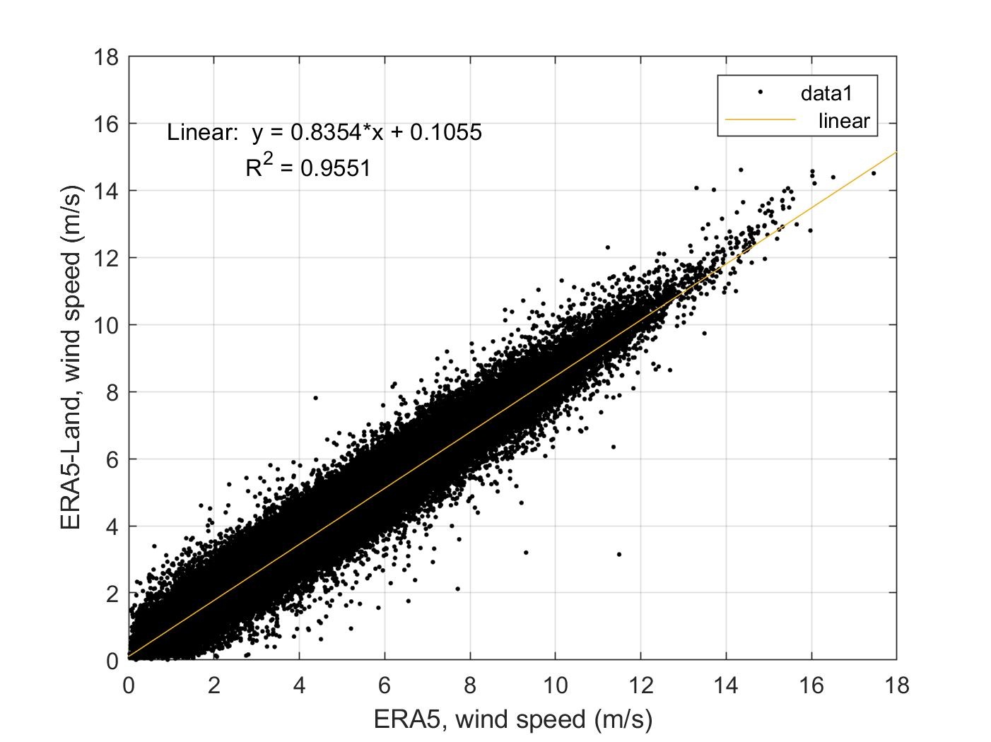
Because I interrogate one specific point location the data from both models is interpolated at the server-side from their own native grids (which I believe is a reduced gaussian grid for ERA5, and I assume(?) a regular 0.1 degree grid for ERA5-Land). I don't know if this is a cause for the differences (i.e. wind in ERA5-Land is then effectively interpolated twice)?
Why are there differences in the wind field between the two datasets, even though ERA5-Land does not actually re-run the atmopsheric fluxes?